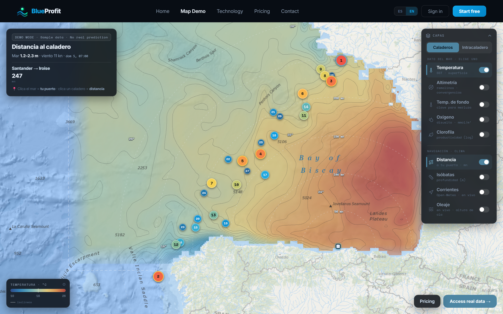
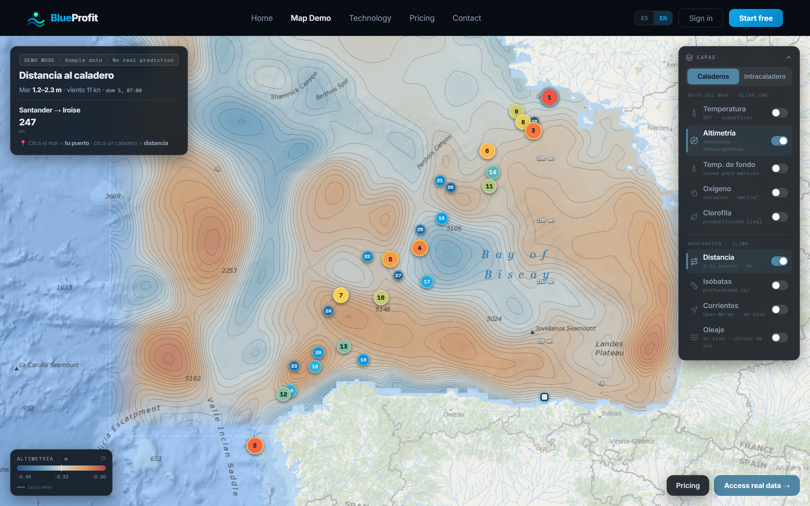
// Technology
Validated performance
on real fishing trips
The data we publish reflects performance on real fishing trips, not lab tests. Our model combines oceanographic data with field observations to generate actionable predictions.
SPATIAL RESOLUTION
0.05° · ~5 km × 5 km per cell
TIME HORIZON
Up to ~9 days ahead
UPDATE FREQUENCY
Daily · updated every day
REGIONAL COVERAGE
Cantabrian Sea · NE Atlantic
TRAINING DATA
Thousands of validated commercial trips
VALIDATION
Multi-year prospective test, no data leakage
Validated performance on real fishing trips
Validated on years the model never saw during training. The zones the model marks as best consistently catch significantly more than those it marks as worst.
Best ground within top 3
82% hit rate
2025 test
#1 ground correct
59% hit rate
2025 test
Lift vs baseline
~2× vs baseline
6-fold CV
MODEL OUTPUT
// Pipeline
01
Oceanographic data
Bottom and surface temperature, chlorophyll, oxygen, nitrate, salinity and depth. Sources: Copernicus Marine Service, EMODnet.
02
Validated fishing data
Thousands of real commercial trips with verified catches, covering multiple years and regions of the NE Atlantic.
03
Habitat suitability
Static habitat suitability mask for Merluccius merluccius from EMODnet, at 0.05° resolution.
04
Predictive CPUE model
Machine learning model trained on oceanographic variables and fishing data. Validated prospectively: the zones the model prioritizes consistently catch more than those it discards, in most analyzed months.
// WHAT THE BACKTEST SHOWS
Validated on 2025+ data, no leakage
▸
Picks the right ground
The ground ranker places the day's best fishing ground within its top 3 in ~82% of cases (top-1 ~59%).
▸
Real uplift where there is signal
Inside grounds with genuine structure, the model's top cells deliver roughly +50% to +100% more CPUE (kg/h) than the lower-ranked cells.
▸
Honest about its limits
Where all cells in a ground are already similar, or data is scarce, the model adds little — those grounds are flagged as low-confidence rather than oversold.
▸
Tested forward
Results measured on 2025+ trips not used in training; the model predicts up to ~9 days ahead.
Ready to try it?
14 days free on all plans. Cancel anytime.